Layanan Kontraktual
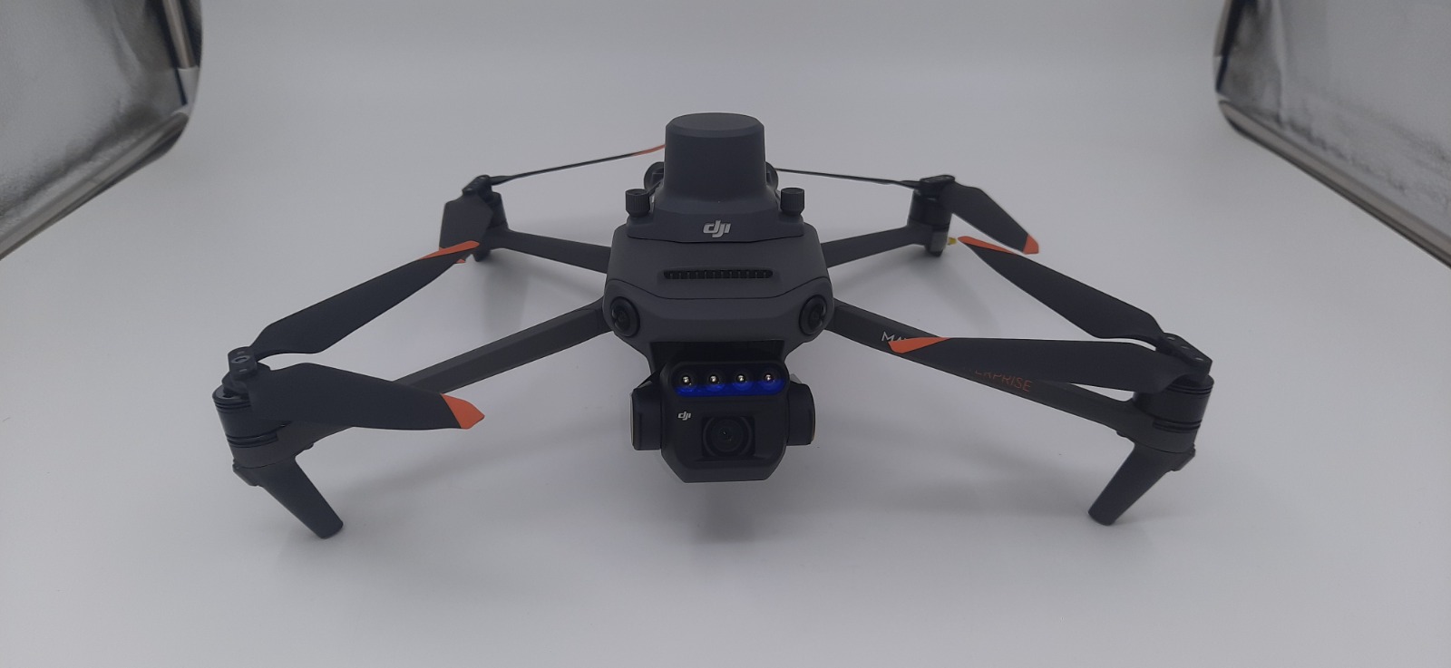
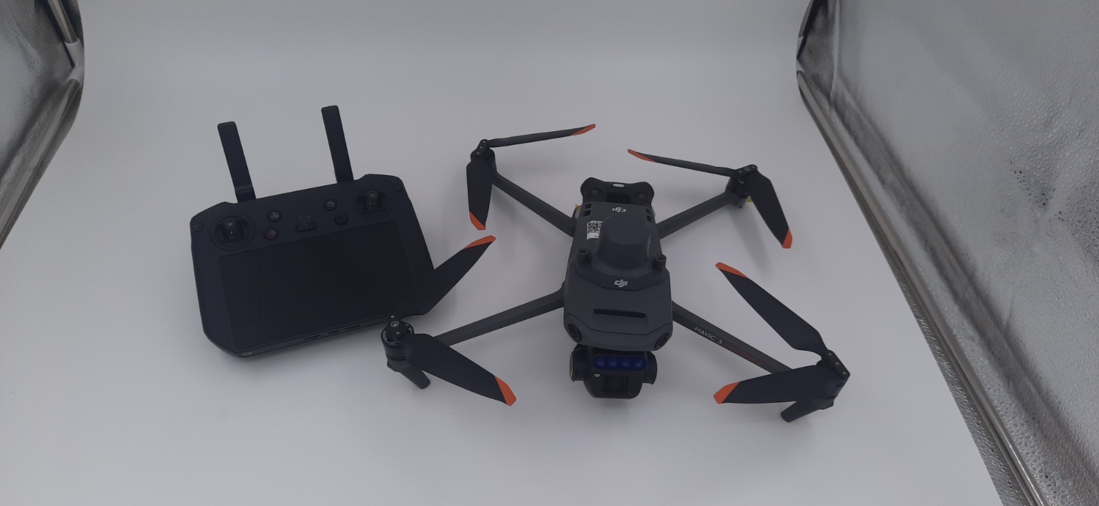
DESKRIPSI LAYANAN | Net Weight (with propellers and RTK module) [1] 951 g Max Takeoff Weight 1,050 g Dimensions (Folded/Unfolded) Folded (without propellers): 223×96.3×122.2 mm (Length×Width×Height) Unfolded (without propellers): 347.5×283×139.6 mm (Length×Width×Height)…
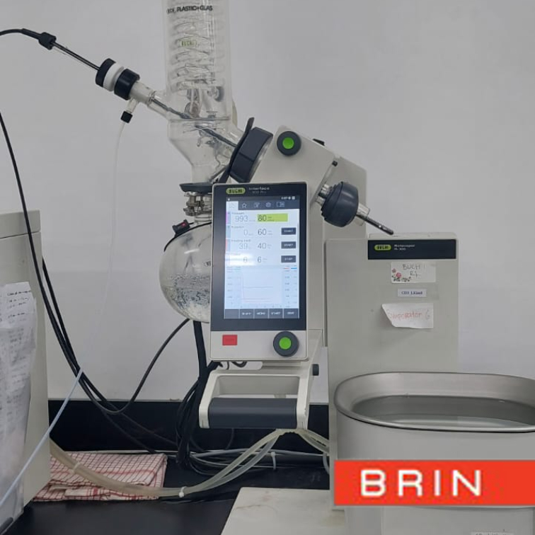
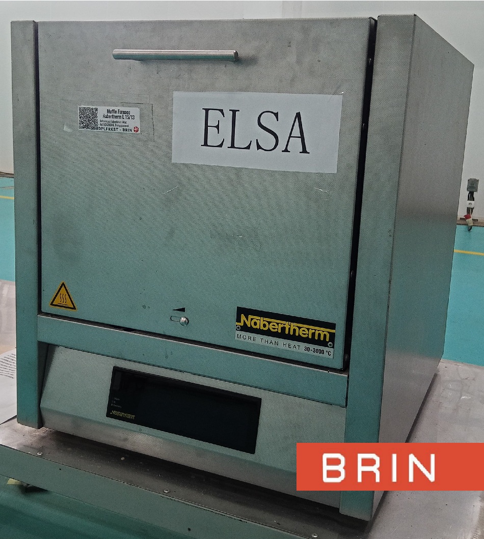
- Laboratorium Alat Survei - Geospatial dan Kartografi
- Direktorat Pengelolaan Laboratorium, Fasilitas Riset, dan Kawasan Sains dan Teknologi
- KST Serpong (Bacharuddin Jusuf Habibie)
KST BJ Habibie Serpong Gedung 255 Laboratorium Alat Survei - 08119811551
- pengelolaan_alatsurvei@brin.go.id
Marketing Office
Deputi Bidang Infrastruktur Riset dan Inovasi BRIN
-
- Net Weight (with propellers and RTK module) [1]
-
951 g
- Max Takeoff Weight
-
1,050 g
- Dimensions (Folded/Unfolded)
-
Folded (without propellers): 223×96.3×122.2 mm (Length×Width×Height)
Unfolded (without propellers): 347.5×283×139.6 mm (Length×Width×Height)
- Diagonal Length
-
Diagonal: 380.1 mm
- Max Ascent Speed
-
6 m/s (Normal Mode)
8 m/s (Sport Mode)
- Max Descent Speed
-
6 m/s (Normal Mode)
6 m/s (Sport Mode)
- Max Flight Speed (at sea level, no wind)
-
15 m/s (Normal Mode)
Flying forward: 21 m/s, flying sideways: 20 m/s, flying backwards: 19 m/s (Sport mode) [2]
- Max Wind Speed Resistance
-
12 m/s [3]
- Max Take-off Altitude Above Sea Level
-
6000 m (without a payload)
- Max Flight Time (without wind)
-
43 minutes [4]
- Max Hover Time (without wind)
-
37 minutes [4]
- Max Flight Distance
-
32 km [6]
- Max Pitch Angle
-
30° (Normal Mode)
35° (Sport Mode)
- Max Angular Velocity
-
200°/s
- GNSS
-
GPS + Galileo + BeiDou + GLONASS (GLONASS is supported only when RTK module is enabled)
- Hovering Accuracy Range
-
Vertical: ±0.1 m (Vision Positioning enabled); ±0.5 m (GNSS Positioning enabled); ±0.1 m (D-RTK enabled)
Horizontal: ±0.3 m (Vision Positioning enabled); ±0.5 m (HD Positioning enabled); ±0.1 m (RTK enabled)
- Operating Temperature
-
-10° to 40° C (14° to 104° F)
- Internal Storage
-
N/A
- Motor Model Number
-
2008
- Propeller Model Number
-
9453F Enterprise Edition
- Light Sensor
-
Built-in module
RGB Camera
- Image Sensor
-
4/3 CMOS
Effective Pixels: 20 MP
- Lens
-
FOV: 84°
Equivalent focal length: 24 mm
Aperture: f/2.8 to f/11
Focus: 1 m to ∞
- ISO Range
-
100-6400
- Shutter speed
-
Electronic shutter: 8-1/8000 s
Mechanical shutter: 8-1/2000 s
- Max Image Size
-
5280×3956
- Photo Shooting Mode
-
Single shot: 20 MP
Timed: 20 MP
JPEG: 0.7/1/2/3/5/7/10/15/20/30/60 s
JPEG + RAW: 3/5/7/10/15/20/30/60 s
Panorama: 20 MP (original material)
- Video Resolution
-
H.264:
4K: 3840×2160@30fps
FHD: 1920×1080@30fps
- Max Video Bitrate
-
4K: 130Mbps
FHD: 70Mbps
- Supported File System
-
exFAT
- Image Format
-
JPEG/DNG (RAW)
- Video Format
-
MP4 (MPEG-4 AVC/H.264)
Multispectral Camera
- Image Sensor
-
1/2.8-inch CMOS, effective pixels: 5 MP
- Lens
-
FOV: 73.91° (61.2° x 48.10°)
Equivalent focal length: 25 mm
Aperture: f/2.0
Focus: Fixed Focus
- Multispectral Camera Band
-
Green (G): 560 ± 16 nm;
Red (R): 650 ± 16 nm;
Red Edge (RE): 730 ± 16 nm;
Near infrared (NIR): 860 ± 26 nm;
- Gain Range
-
1x-32x
- Shutter Speed
-
Electronic Shutter: 1/30~1/12800 s
- Max Image Size
-
2592×1944
- Image Format
-
TIFF
- Video Format
-
MP4 (MPEG-4 AVC/H.264)
- Photo Shooting Mode
-
Single shot: 5 MP
Timelapse: 5 MP
TIFF: 2/3/5/7/10/15/20/30/60 s
- Video Resolution
-
H.264
FHD: 1920 x 1080@30fps
Video content: NDVI/GNDVI/NDRE
- Max Video Bitrate
-
Stream: 60 Mbps
Gimbal
- Stabilization System
-
3-axis mechanical gimbal (tilt, roll, pan)
- Mechanical Range
-
Tilt: -135° to 45°
Roll: -45° to 45°
Pan: -27° to 27°
- Controllable Range
-
Tilt: -90° to 35°
Pan: Uncontrollable
- Max Control Speed (tilt)
-
100°/s
- Angular Vibration Range
-
±0.007°
Sensing System
- Sensing System Type
-
Omnidirectional binocular vision system, with an infrared sensor at the bottom of the aircraft
- Forward
-
Distance Measuring Range: 0.5 m to 20 m
Detection Range: 0.5 m to 200 m
Effective Obstacle Avoidance Speed: Flight Speed ≤15 m/s
FOV: Horizontal 90°, vertical 103°
- Backward
-
Distance Measuring Range: 0.5 m to 16 m
Effective Obstacle Avoidance Speed: Flight speed ≤12 m/s
FOV: Horizontal 90°, vertical 103°
- Lateral
-
Distance Measuring Range: 0.5 m to 25 m
Effective Obstacle Avoidance Speed: Flight speed ≤15 m/s
FOV: Horizontal 90°, vertical 85°
- Upward
-
Distance Measuring Range: 0.2 m to 10 m
Effective Obstacle Avoidance Speed: Flight Speed ≤6 m/s
FOV: Front and rear 100°, left and right 90°
- Downward
-
Distance Measuring Range: 0.3 m to 18 m
Effective Obstacle Avoidance Speed: Flight speed ≤6 m/s
FOV: Front and rear 130°, left and right 160°
- Operating Environment
-
Front, Rear, Left, Right, Above: Surfaces with clear patterns and adequate lighting (> 15 lux, environments with normal indoor fluorescent light exposure)
Below: Surfaces with diffuse reflection material and a reflectivity of >20% (such as walls, trees, people, etc.); Adequate lighting (>15 lux, environments with normal indoor fluorescent light exposure)
Video Transmission
- Video Transmission System
-
DJI O3 Image Transmission Industry Edition
- Live View Quality
-
Remote Controller: 1080p/30fps
- Operating Band [7]
-
2.400-2.4835 GHz
5.725-5.850 GHz
- Max Effective Signal Distance (Unobstructed, No interference) [8]
-
FCC: 15 km
CE: 8 km
SRRC: 8 km
MIC: 8 km
- Max Transmission Distance (Obstructed) [9]
-
Strong Interference (urban landscapes, residential areas, etc.): 1.5-3 km (FCC/CE/SRRC/MIC)
Medium Interference (suburban landscapes, city parks, etc.): 3-9 km (FCC), 3-6 km (CE/SRRC/MIC)
Weak Interference (remote fields, open farmland, etc.): 9-15 km (FCC), 6-8 km (CE/SRRC/MIC)
- Max Download Speed
-
15 MB/s (with DJI RC Pro Industry Edition)
- Latency (depending on environment and mobile device)
-
Approximately 200 milliseconds
- Antennas
-
4 antennas, 2 transmitting and 4 receiving
- Transmitter Power (EIRP)
-
2.4 GHz: <33> 5.8 GHz: <33>
- Other
-
Supports the DJI Cellular module
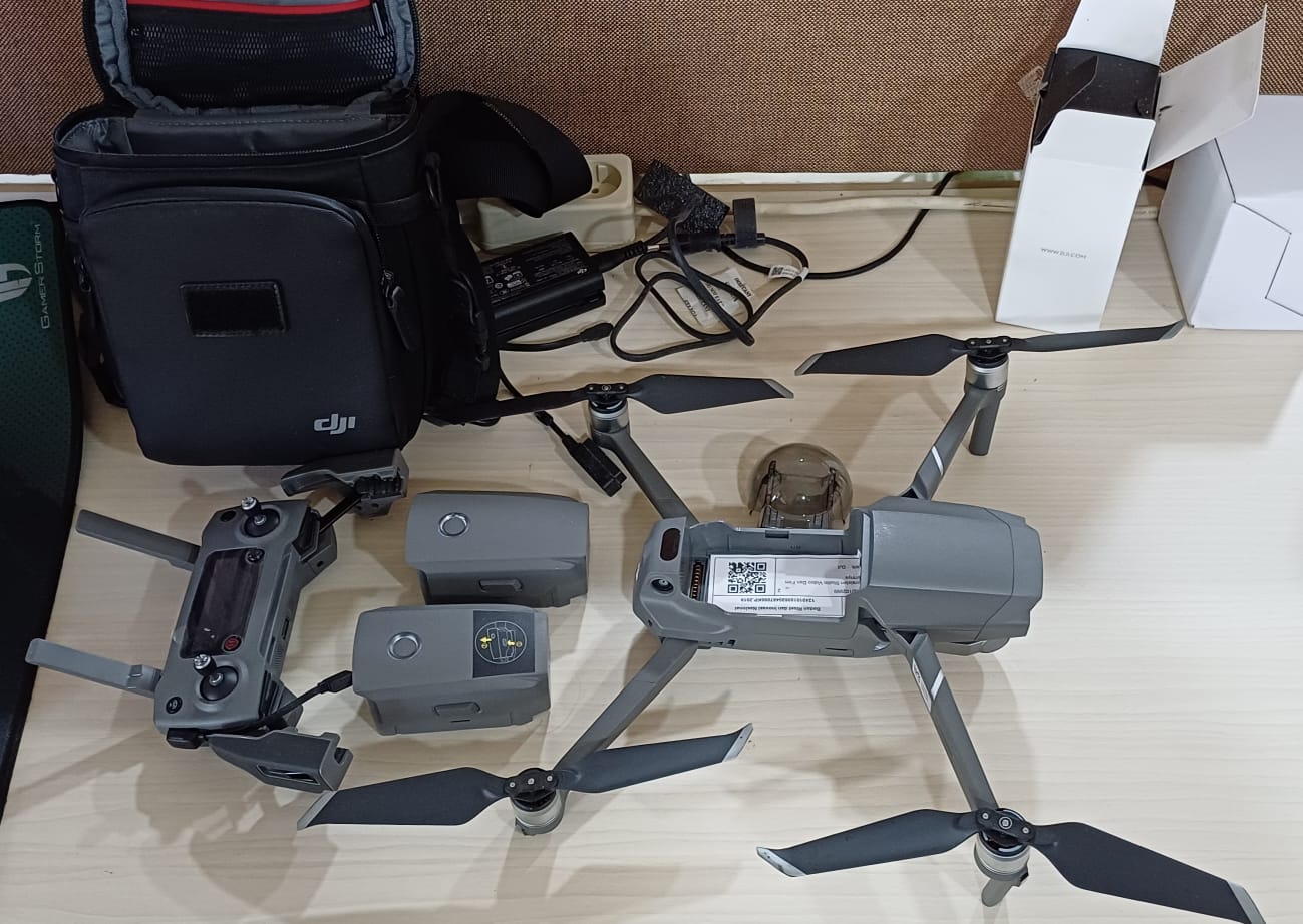
Kelengkapan:
1 unit drone 3M enterprise
1 unit RC Pro Enterprise
4 unit Aircraft Battery
1 unit RTK Module
1 unit USB-C to USB-C Cable
1 unit USB-C Cable
1 unit Adapter
1 unit Power Cable
3 pair Propellers
1 unit Charging Hub