Paid
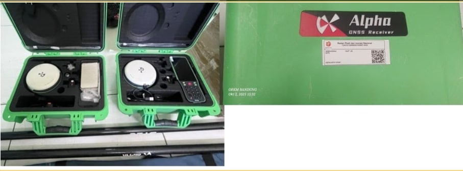
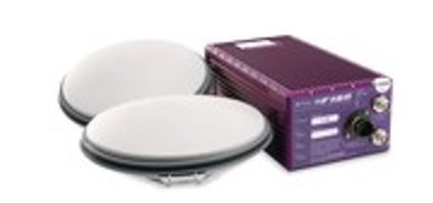
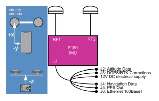
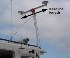
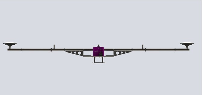
SERVICE DESCRIPTION | The F180® Series is a family of GPS-assisted attitude and positioning systems that provide high-quality, precise reference data for a number of marine applications including multi-beam surveys and dynamic positioning projects. Combining GNSS information…
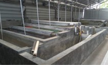
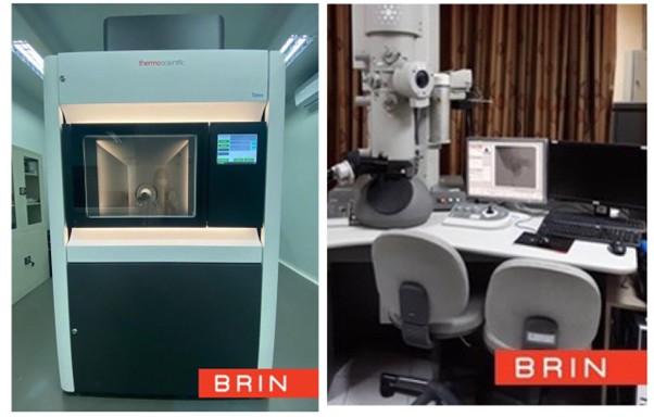
- Laboratorium Alat Survei - Kelautan dan Lingkungan
- KST Serpong (Bacharuddin Jusuf Habibie)
KST BJ Habibie Serpong Gedung 255 Laboratorium Alat Survei - 08119811551
- pengelolaan_alatsurvei@brin.go.id
Marketing Office
Deputi Bidang Infrastruktur Riset dan Inovasi BRIN
layanan_sains@brin.go.id
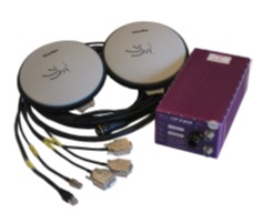
The F180® Series is a family of GPS-assisted attitude and positioning systems that provide high-quality, precise reference data for a number of marine applications including multi-beam surveys and dynamic positioning projects. Combining GNSS information with an inertial engine, the F180 series produces variable heading, position, heave, pitch and roll with Kalman filters, even in the roughest sea conditions.
With special Motion software, every model in the F180 series can be mobilized and calibrated in a very short time. With advanced inertial engines, the F180 series is very stable and can maintain high precision of ship motion output data even following narrow ship turns.
In the various models that make up the F180 series there is the ability to upgrade the solution using a number of corrections including RTK (up to 1 cm), DGPS, SBAS (WAAS/EGNOS/MSAS) plus the addition of Atlas™ Global Correction Service via the AtlasLink™ GNSS Smart Antenna on the F190 and F190+ systems for L-band reception.
Further improvements to the heave output to eliminate low period waves, can be done using the iHeave software component. Running in near real time, iHeave is an intelligent heave processing module that will not only remove low-period wave artifacts, but can also be used to remove other heave noise that arises during sharp turns and the like.
The F180 Series supplies reliable position, heading and movement data for the offshore industry.
Features:
Provides high accuracy, heave, pitch, and roll.
Precise heading and position.
Offers position accuracy up to 1 cm with RTK.
Remote lever-arm.
Cmpatible with HYPACK, QINSY, WAAS & EGNOS.
Extremely compact and rugged
Simple to install and configure
Intelligent heave processing
Standard data formats and interfaces
Specific high-performance variant for inland waterways, ports, and harbors
Specifications:
Dimensions: 120x234x80mm (4.73 x 9.2 x 3.15”)
Weight: 2.5kg (5.5 lb)
Power: 9-18Vdc, 25 watts (110-240Vac adapter supplied)
Antenna Cables: 15m standard (30m optional)
Operating Temperature: -10 to 60°C
Applications:
Hydrographic survey
Bridge, dam, harbour inspection
Offshore renewable energy and environmental survey
Shipping channel survey
Marine laser scan survey