Paid
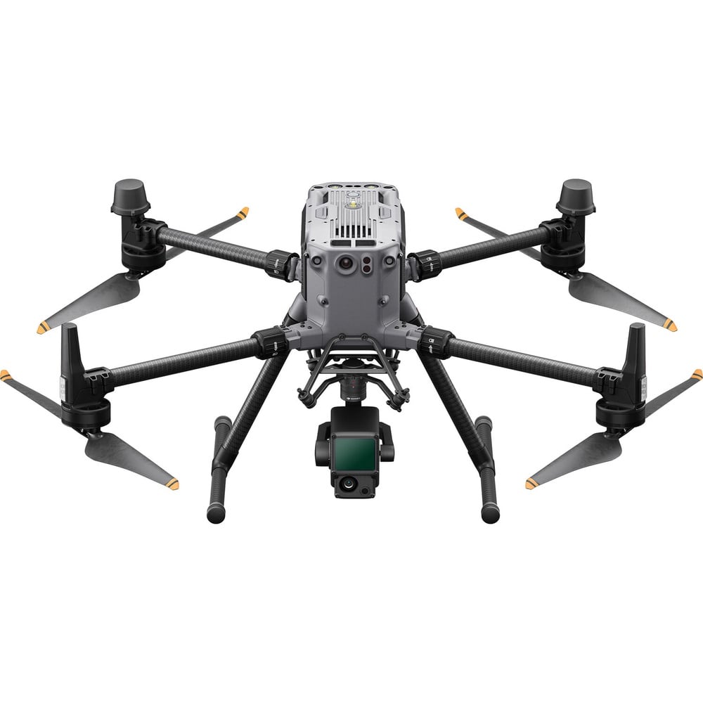
SERVICE DESCRIPTION | (must hold a licensed drone pilot certification) The DJI M350 RTK drone with the Zenmuse L2 LiDAR is a high-precision aerial mapping tool that utilizes a LiDAR sensor, RGB camera, and RTK system to generate accurate 3D data. The L2 LiDAR can detect objects…
- Laboratorium Alat Survei - Geospatial dan Kartografi
- KST Serpong (Bacharuddin Jusuf Habibie)
KST BJ Habibie Serpong Gedung 255 Laboratorium Alat Survei - 08119811551
- pengelolaan_alatsurvei@brin.go.id
Marketing Office
Deputi Bidang Infrastruktur Riset dan Inovasi BRIN
layanan_sains@brin.go.id
(must hold a licensed drone pilot certification) The DJI M350 RTK drone with the Zenmuse L2 LiDAR is a high-precision aerial mapping tool that utilizes a LiDAR sensor, RGB camera, and RTK system to generate accurate 3D data. The L2 LiDAR can detect objects up to 450 meters away with vertical accuracy of ±4 cm and horizontal accuracy of ±5 cm. It is used for topographic surveying, land mapping, and infrastructure inspection with high efficiency, even in areas covered by vegetation. The drone offers a flight time of up to 55 minutes and a durable design for operation in various field conditions.