Paid
SERVICE DESCRIPTION | FISH FINDER GARMIN GPSMAP 585 Plus General description The Garmin GPSMap 585 Plus fish finder is able to provide a clearer picture of what is in the water column as a photographic image with representations of objects, structures and fish. GPSMAP 585…
- Laboratorium Alat Survei - Kelautan dan Lingkungan
- Puspiptek - Serpong
KST BJ Habibie Serpong Gedung 255 Laboratorium Alat Survei - 08119811551
- pengelolaan_alatsurvei@brin.go.id
Marketing Office
Deputi Bidang Infrastruktur Riset dan Inovasi BRIN
layanan_sains@brin.go.id
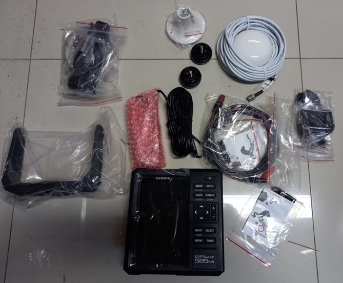
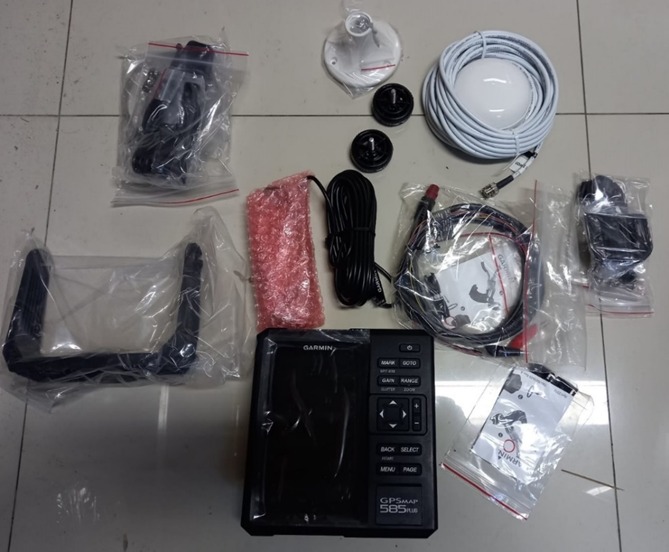
FISH FINDER GARMIN GPSMAP 585 Plus
General description
The Garmin GPSMap 585 Plus fish finder is able to provide a clearer picture of what is in the water column as a photographic image with representations of objects, structures and fish. GPSMAP 585 Plus' built-in sonar capabilities include CHIRP sonar with Sonar Frequency: 50/77/200kHz CHIRP (Low/Mid/High) with the most advanced sonar technology available for fishing and boating to the public. CHIRP sonar provides excellent target separation and definition because it puts more energy into the target than traditional sonar. The device also features sonar recording capability which coordinates the time of sonar return with your vessel's position and stores the digital information for playback on a computer using navigation software. With multi-position mode support for three powerful systems GPS, GLONASS and BeiDou. Quick and easy device to give up to 12,000 accurate waypoints and find your way back to your secret fishing spot. Large capacity memory to help fishermen record danger points (Mark) and destinations (Waypoints). As well as supporting ship navigation with support for Preloaded maps: GPSMAP 585 Plus; w/g2; SEA (built-in SEA g2 chart), GPSMAP 585 Plus with built-in g2 chart, and Compass Pages to Know at a Glance about COG and SOG
Equipment Equipment
Receivers
Receiver Mount
GPS Antenna, Antenna Cable and GPS antenna holder
DC power cable and RS 232 data cable
Transducer and Cable Transducer
Specification
Additional Map Yes
Product dimensions 176.0 mm x 190.0 mm x 66.0 mm
Navigation Features Garmin Sonar compatible
Supports AIS (tracks target ships position)
Garmin Sonar compatible
Supports DSC (displays position data from DSC-capable VHF radio)
Tide tables
Product Weight 816.0 g
Connectivity Transducer Connector Pin Numbers: 8
8-Pin Power/NMEA 0183 Connector: 1
BNC for External GPS Antenna: 1
Receiver Type GPS/GLONASS/BeiDou, internal
Number of Tracks one 50,000 points active track; 100 saved
tracks
Number of Routes 200
Number of Waypoints 12000
Basemap Yes
External Antenna Available
Others Water rating: IPX7
NMEA 0183/RS422 compatible
Mounting options: Bail or flush
Accepts data cards: 2 standard SD
Scanning Sonar Frequency: CHIRP 260/455/800kHz
Maximum depth: 2,300 ft, freshwater, 1,100 ft, saltwater (depth capacity is dependent on bottom water type and other water conditions)
Sonar Features: Bottom lock (shows return from the bottom up), Water temperature log and graph, Split-screen zoom, Fish Symbol ID (helps
identify fish targets),
Sonar recording, Sonar history rewind
Display WVGA 480 x 800 pixels
Power Supply Power consumption: 7.6 W