Paid
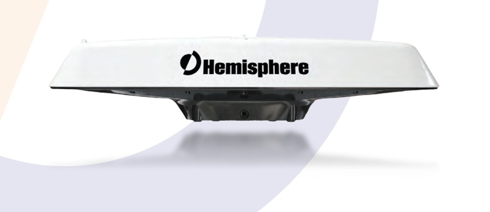
SERVICE DESCRIPTION | GPS Compass Hemisphere V113 is a complete GPS and GLONASS compass system for heading and positioning in one device that only requires one power/data cable connection. V113 has no mechanical parts such as gimbals, rotary motors, so it is free from routine…
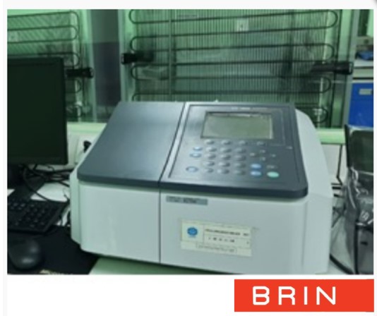
- Laboratorium Alat Survei - Kelautan dan Lingkungan
- KST Serpong (Bacharuddin Jusuf Habibie)
KST BJ Habibie Serpong Gedung 255 Laboratorium Alat Survei - 08119811551
- pengelolaan_alatsurvei@brin.go.id
Marketing Office
Deputi Bidang Infrastruktur Riset dan Inovasi BRIN
layanan_sains@brin.go.id
GPS Compass Hemisphere V113 is a complete GPS and GLONASS compass system for heading and positioning in one device that only requires one power/data cable connection. V113 has no mechanical parts such as gimbals, rotary motors, so it is free from routine maintenance. Because the heading is taken from GNSS, there is no need for settling time, gyrocompass calibration, and speed correction. The Vector Performance of V113 which is not affected by the earth's magnetic field (geomagnetism) and the easy installation process makes V113 the right solution for various marine applications such as Radar/ARPA, ECDIS, Sonar, Pemerum Pluma, and so on.
Operating Principle
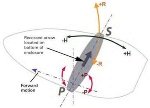
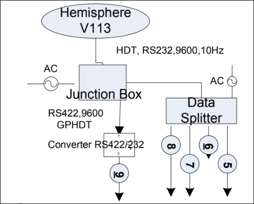
The GPS Compass Hemisphere V113 system uses a high-performance GNSS receiver and 2 antennas to process satellite signals to obtain accurate and reliable position and direction/heading information at a high update rate. One antenna is designed as a primary GNSS antenna and the other as a secondary GNSS antenna. Position data is obtained by calculation referenced to the phase center of the primary GNSS antenna, while heading data is calculated using a vector reference formed from the phase center of the primary to the secondary GNSS antenna. The GNSS receiver uses a complex algorithm by combining satellite locations and distances to each satellite to obtain geographic location and heading. The receiver uses 4 or more GNSS signals to perform calculations to obtain valid three-dimensional coordinates and heading.
Specification
Receiver type: GNSS L1 RTK
Channels: 540
GPS sensitivity: -142 dBm
SBAS tracking: 2-channel, parallel tracking
Update rate: 50 Hz (position and heading)
Position accuracy: RMS (67%): Horizontal Vertical Single Point, no SA: 1.2 m 2.5 m SBAS (WAAS): 0.3 m 0.6 m. L-band DGPS: 0.3 m 0.6 m. Code Differential GPS: 0.3 m 0.6 m L- band L1/L2: 0.15 m 0.3 m. RTK:10 mm + 1 ppm 20 mm + 2 ppm
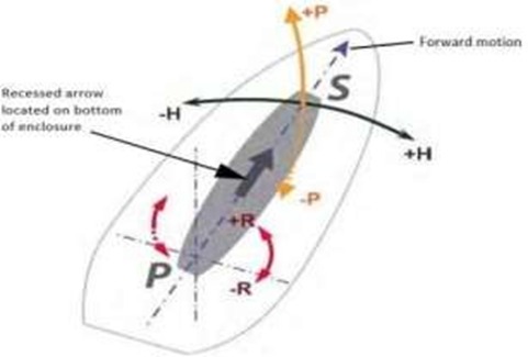
Heading accuracy: < 0> Heave accuracy < 30> Pitch accuracy < 1> Roll accuracy < 1> Inertial sensor
Timing (1 PPS) accuracy: 50 ns
Rate of turn: 90°/s maximum
Cold start: < 60> Warm start: < 20> Hot start: < 1> Heading fix: < 10> Compass safe distance: 75 cm (29.5 in)4
Maximum speed: 1,850 kph (999 kts)
Maximum altitude: 18,288 m (60,000 ft)
Enclosure: UV resistant, white plastic, AES HW 600G, non corrosive, self-extinguishing
Dimensions: 66.3 L x 20.9 W x 14.6 H (cm). 26.1 L x 8.3 W x 5.8 H (in)
Weight: V113 2.4 kg (5.4 lb)
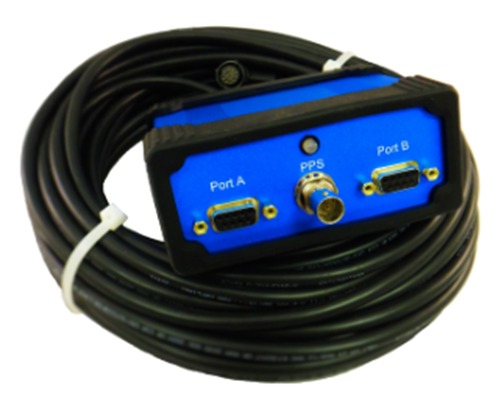
Power/data connector: 18-pin, environmentally sealed
Operating temperature: -30°C to +70°C (-22°F to +158°F)
Storage temperature: -40°C to +85°C (-40°F to +185°F)
Humidity: 95% non-condensing
Vibration: IEC 60945