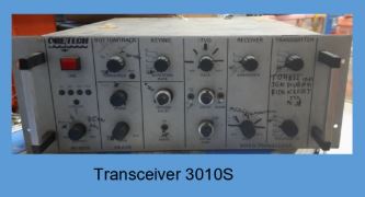
SERVICE DESCRIPTION | HYPACK 6.2A is an enhancement of nearly one year from the previous version, HYPACK 6.2, and offers a ready-to-use survey package for acquiring and processing bathymetric data, ADCP, magnetometer, and side scan sonar, as well as mapping tools for producing…
- Laboratorium Alat Survei - Kelautan dan Lingkungan
- KST Serpong (Bacharuddin Jusuf Habibie)
KST BJ Habibie Serpong Gedung 255 Laboratorium Alat Survei - 08119811551
- pengelolaan_alatsurvei@brin.go.id
HYPACK 6.2A is an enhancement of nearly one year from the previous version, HYPACK 6.2, and offers a ready-to-use survey package for acquiring and processing bathymetric data, ADCP, magnetometer, and side scan sonar, as well as mapping tools for producing S-57. Among the features of Version 6.2A are the new AIS (Autonomous Identification System) integration, CUBE Data processing, ENC Editor integration, and support for BSB version 4 and S63 background charts. HYPACK 6.2A is ready for Windows Vista.
HYPACK 6.2A is navigation software used for hydrographic surveying. It can be used for planning and recording survey lines, collecting data, and creating electronic charts, allowing users to design surveys, gather data, and generate reports.
Features:
- Survey Path Planning: Plan and record survey paths in real-time.
- Data Collection: Collect data, apply measurement corrections, and remove outliers.
- Chart Creation: Create and modify electronic charts.
- Contour Generation: Create contours.
- Side Scan Mosaic Creation: Create side scan mosaics.
- Volume Calculation: Calculate volume quantities.
- Field Sheet Mapping: Create field sheet plots.
- CAD Data Export: Export data to CAD.
Applications:
- HYPACK 6.2A has been used to record telemetry and acoustic navigation data.
- HYPACK 6.2A has been used to plan and record survey paths for oceanographic sampling.
System Requirements:
- OS: Windows XP, Windows 7 (version 6.2a is an older version and may not be compatible with the latest OS).
- RAM: Minimum 2GB (higher recommended for large data processing).
- Storage: Minimum 10GB of free space for survey data storage.
- Serial/USB Port for connectivity with survey equipment.