Paid
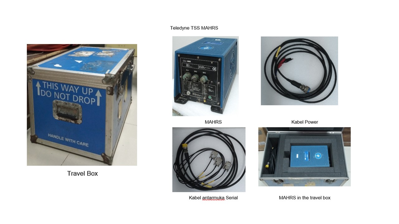
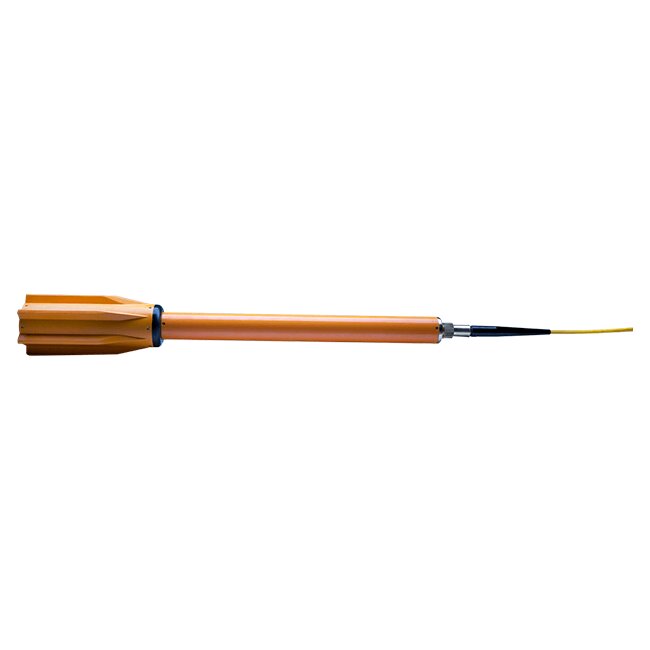
SERVICE DESCRIPTION | Motion Sensor Merk:Teledyne TSS MAHRS (Meridian Attitude & Heading Reference System) Kelengkapan: MAHRS Power Cable Kabel antar muka Serial RS232 (2 keluaran dan 1 masukan untuk aiding GPS) Fungsi: Attitude and heading reference system untuk penggunaan…
- Laboratorium Alat Survei - Alat Survei Geosains Darat
- KST Serpong (Bacharuddin Jusuf Habibie)
KST BJ Habibie Serpong Gedung 255 Laboratorium Alat Survei - 08119811551
- pengelolaan_alatsurvei@brin.go.id
Marketing Office
Deputi Bidang Infrastruktur Riset dan Inovasi BRIN
layanan_sains@brin.go.id
Motion Sensor
Merk:Teledyne TSS MAHRS (Meridian Attitude & Heading Reference System)
Kelengkapan:
Fungsi:
Spesifikasi Teknis
Performa MAHRS
Heading
Settle Point error±0.1° secant latitude
Static error±0.05° RMS secant latitude
Dynamic accuracy0.2° RMS secant latitude
Settle point repeatablity±0.1° secant latitude
Follow up speed~ 200°/s
Alignment time< 45> Heading latency< 25ms>
Roll and Pitch
Resolution0.01°
Range±45°
Dynamic accuracy0.03° RMS (for a 5° amplitude), 0.05° RMS (for >5° amplitude)
Limits± 45°
Axis alignment with headingBetter than 0.1°
Roll and Pitch Latency< 3>
Heave
Accuracy5 cm or 5% whichever is greater (period 0 to 20s)
Resolution1 cm
Compensation
Latitude80 N to 80 S
Speed0 – 90 knots
Power Supply
Voltage24VDC (18-36 VDC)
Power Consumption5A at Power On, 2.5A at operating
Interface
Digital output2 serial ports RS232, baud rates 1200, 2400, 4800, 9600, 19200, 38400
Data output rateDigital – up to 100 Hz
Digital output formatTSS HRP, TSS1 + NMEA HDT, TSS1 default, TSS1 with remote heave, TSS3, Simrad EM1000, Simrad EM1000 with remote heave, Simrad EM3000, Simrad EM3000 with remote heave, NMEA PRDID, DMT1, Polled, user configurable, NMEA HDT, NMEA ROT, S G Brown (1/10th), Robertson
Physical Characteristic
Dimensions242 mm (h) x 232 mm (w) x 429mm (d)
Weight in air18.5 kg
Weight in waterN/A
RatingIP65
Environmental and EMC
Operating temperature-10°C to +55°C
Storage temperature-20°C to +70°C
EnvironmentalIEC 60945
EMCIEC 60945
MTBF>30,000 hours
Shock (Survival)>10g
Merk:Teledyne TSS MAHRS (Meridian Attitude & Heading Reference System)
Kelengkapan:
- MAHRS
- Power Cable
- Kabel antar muka Serial RS232 (2 keluaran dan 1 masukan untuk aiding GPS)
Fungsi:
- Attitude and heading reference system untuk penggunaan pada survei hidrografi
- Attitude and heading system untuk penggunaan pada kapal survei yang mempunyai tingkat belokan yang ekstrem 200°/detik pada lingkungan sungai atau pelabuhan
Spesifikasi Teknis
Performa MAHRS
Heading
Settle Point error±0.1° secant latitude
Static error±0.05° RMS secant latitude
Dynamic accuracy0.2° RMS secant latitude
Settle point repeatablity±0.1° secant latitude
Follow up speed~ 200°/s
Alignment time< 45> Heading latency< 25ms>
Roll and Pitch
Resolution0.01°
Range±45°
Dynamic accuracy0.03° RMS (for a 5° amplitude), 0.05° RMS (for >5° amplitude)
Limits± 45°
Axis alignment with headingBetter than 0.1°
Roll and Pitch Latency< 3>
Heave
Accuracy5 cm or 5% whichever is greater (period 0 to 20s)
Resolution1 cm
Compensation
Latitude80 N to 80 S
Speed0 – 90 knots
Power Supply
Voltage24VDC (18-36 VDC)
Power Consumption5A at Power On, 2.5A at operating
Interface
Digital output2 serial ports RS232, baud rates 1200, 2400, 4800, 9600, 19200, 38400
Data output rateDigital – up to 100 Hz
Digital output formatTSS HRP, TSS1 + NMEA HDT, TSS1 default, TSS1 with remote heave, TSS3, Simrad EM1000, Simrad EM1000 with remote heave, Simrad EM3000, Simrad EM3000 with remote heave, NMEA PRDID, DMT1, Polled, user configurable, NMEA HDT, NMEA ROT, S G Brown (1/10th), Robertson
Physical Characteristic
Dimensions242 mm (h) x 232 mm (w) x 429mm (d)
Weight in air18.5 kg
Weight in waterN/A
RatingIP65
Environmental and EMC
Operating temperature-10°C to +55°C
Storage temperature-20°C to +70°C
EnvironmentalIEC 60945
EMCIEC 60945
MTBF>30,000 hours
Shock (Survival)>10g


